Property Record
136 Tomahawk Dr, Satellite Beach, FL 32937

NEARBY LISTINGS FOR SALE OR LEASE
-
-
View all Satellite Beach listings for lease on LoopNet.com
Property Detail
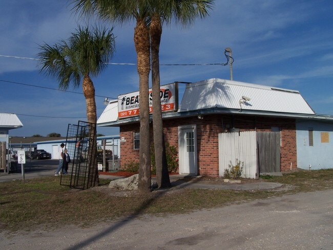
136 Tomahawk Dr
27-37-02-00-00549.0-0000.00
PART OF SE 1/4 OF SW 1/4 AS DES IN ORB 1446 PG 320
Publicstorage
Brevard
X
Florida
12009C0536H
0.83 AC
2025
Brevard County
2025
Orlando
066500
Palm Bay-Melbourne-Titusville, FL
14,000 SF
DEMOGRAPHICS near 136 Tomahawk Dr
1 mile
3 mile
5 mile
2024 Total Population
10,316
36,698
89,532
2029 Population
11,250
40,093
97,474
Pop Growth 2024-2029
+ 9.05%
+ 9.25%
+ 8.87%
Average Age
46
46
44
2024 Total Households
4,287
16,268
39,158
HH Growth 2024-2029
+ 8.89%
+ 9.04%
+ 8.64%
Median Household Inc
$101,542
$80,298
$71,763
Avg Household Size
2.30
2.20
2.20
2024 Avg HH Vehicles
2.00
2.00
2.00
Median Home Value
$375,448
$359,677
$304,756
Median Year Built
1975
1978
1980
Nearby Places
Map Layers
Map Styles
 Street
 Aerial
Transit
 Traffic
 Biking
Places
Listings with unknown addresses are not visible on the map
- Restaurants
- Banks
- Shops
- Fitness
- Groceries
PUBLIC TRANSPORTATION
AIRPORT
Melbourne Orlando International
Drive
Walk
Distance
Melbourne Orlando International
20 min
8.6 mi
Freight Ports
Port Canaveral
Drive
Walk
Distance
Port Canaveral
36 min
18.4 mi
SALE & LEASE HISTORY
LISTING DATE
SALE/LEASE

Aug 02, 2017
For Lease
Nearby Properties
Address
Land Use
TOTAL SIZE
Lot Size
Zoning
Address
Land Use
TOTAL SIZE
Lot Size
Zoning
511,907 SF
75.60 AC
ITU
Address
Land Use
TOTAL SIZE
Lot Size
Zoning
289,263 SF
13.96 AC
R2
Address
Land Use
TOTAL SIZE
Lot Size
Zoning
225,168 SF
7.06 AC
R3
Address
Land Use
TOTAL SIZE
Lot Size
Zoning
187,107 SF
10.87 AC
Address
Land Use
TOTAL SIZE
Lot Size
Zoning
173,965 SF
4.28 AC
C1
Address
Land Use
TOTAL SIZE
Lot Size
Zoning
169,387 SF
28.25 AC
INL
Address
Land Use
TOTAL SIZE
Lot Size
Zoning
2,710 SF
12.04 AC
I1
Address
Land Use
TOTAL SIZE
Lot Size
Zoning
252,942 SF
29.76 AC
R3
Address
Land Use
TOTAL SIZE
Lot Size
Zoning
116,309 SF
2.56 AC
TU-1
Address
Land Use
TOTAL SIZE
Lot Size
Zoning
188,093 SF
13.11 AC
R2
Address
Land Use
TOTAL SIZE
Lot Size
Zoning
192,888 SF
5.66 AC
Address
Land Use
TOTAL SIZE
Lot Size
Zoning
162,759 SF
8.49 AC
RU230
Address
Land Use
TOTAL SIZE
Lot Size
Zoning
182,969 SF
14.64 AC
B1
Address
Land Use
TOTAL SIZE
Lot Size
Zoning
184,197 SF
12 AC
R1AAA
Address
Land Use
TOTAL SIZE
Lot Size
Zoning
145,250 SF
10.85 AC
CR1A
Address
Land Use
TOTAL SIZE
Lot Size
Zoning
2,574 SF
89.66 AC
Address
Land Use
TOTAL SIZE
Lot Size
Zoning
94,097 SF
3.21 AC
R2
Address
Land Use
TOTAL SIZE
Lot Size
Zoning
118,607 SF
9.67 AC
CP
Address
Land Use
TOTAL SIZE
Lot Size
Zoning
106,333 SF
2.52 AC
B1
Address
Land Use
TOTAL SIZE
Lot Size
Zoning
135,578 SF
3.86 AC
I1
Address
Land Use
TOTAL SIZE
Lot Size
Zoning
7.02 AC
ITU
Address
Land Use
TOTAL SIZE
Lot Size
Zoning
152,762 SF
13.70 AC
C
Address
Land Use
TOTAL SIZE
Lot Size
Zoning
2,792 SF
6.36 AC
ITU
Address
Land Use
TOTAL SIZE
Lot Size
Zoning
144,052 SF
13.28 AC
B1
Address
Land Use
TOTAL SIZE
Lot Size
Zoning
742 SF
2.04 AC
GML
Address
Land Use
TOTAL SIZE
Lot Size
Zoning
52,325 SF
2.40 AC
C1
Address
Land Use
TOTAL SIZE
Lot Size
Zoning
55,552 SF
1.50 AC
Address
Land Use
TOTAL SIZE
Lot Size
Zoning
72,781 SF
9.54 AC
IN(L)
Address
Land Use
TOTAL SIZE
Lot Size
Zoning
99,628 SF
9.97 AC
CP
Address
Land Use
TOTAL SIZE
Lot Size
Zoning
1,840 SF
2 AC
The World's #1 Commercial Real Estate Marketplace
Connect with us
© 2026 CoStar Group
The information above has been obtained from sources believed reliable. While we do not doubt its accuracy we have not verified it and make no guarantee, warranty or representation about it. It is your responsibility to independently confirm its accuracy and completeness. Any projections, opinions, assumptions, or estimates used are for example only and do not represent the current or future performance of the property. The value of this transaction to you depends on tax and other factors which should be evaluated by your tax, financial, and legal advisors. You and your advisors should conduct a careful, independent investigation of the property to determine to your satisfaction the suitability of the property for your needs.